-
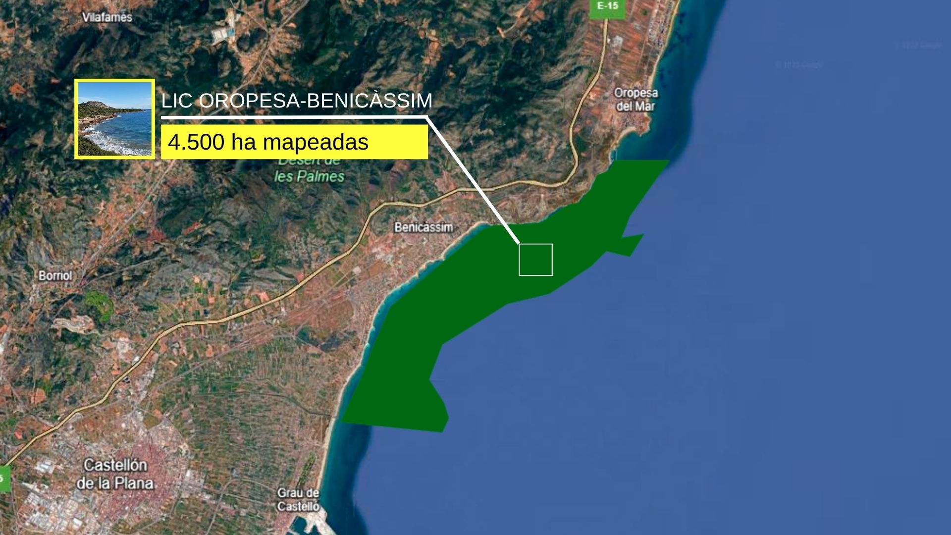
The Oceanogràfic Foundation and the Ciutat de les Arts i les Ciències’ ‘Projecte Posidònia’ includes the new mapping of the Oropesa–Benicàssim SCI thanks to the Fundación Azul Marino.
-
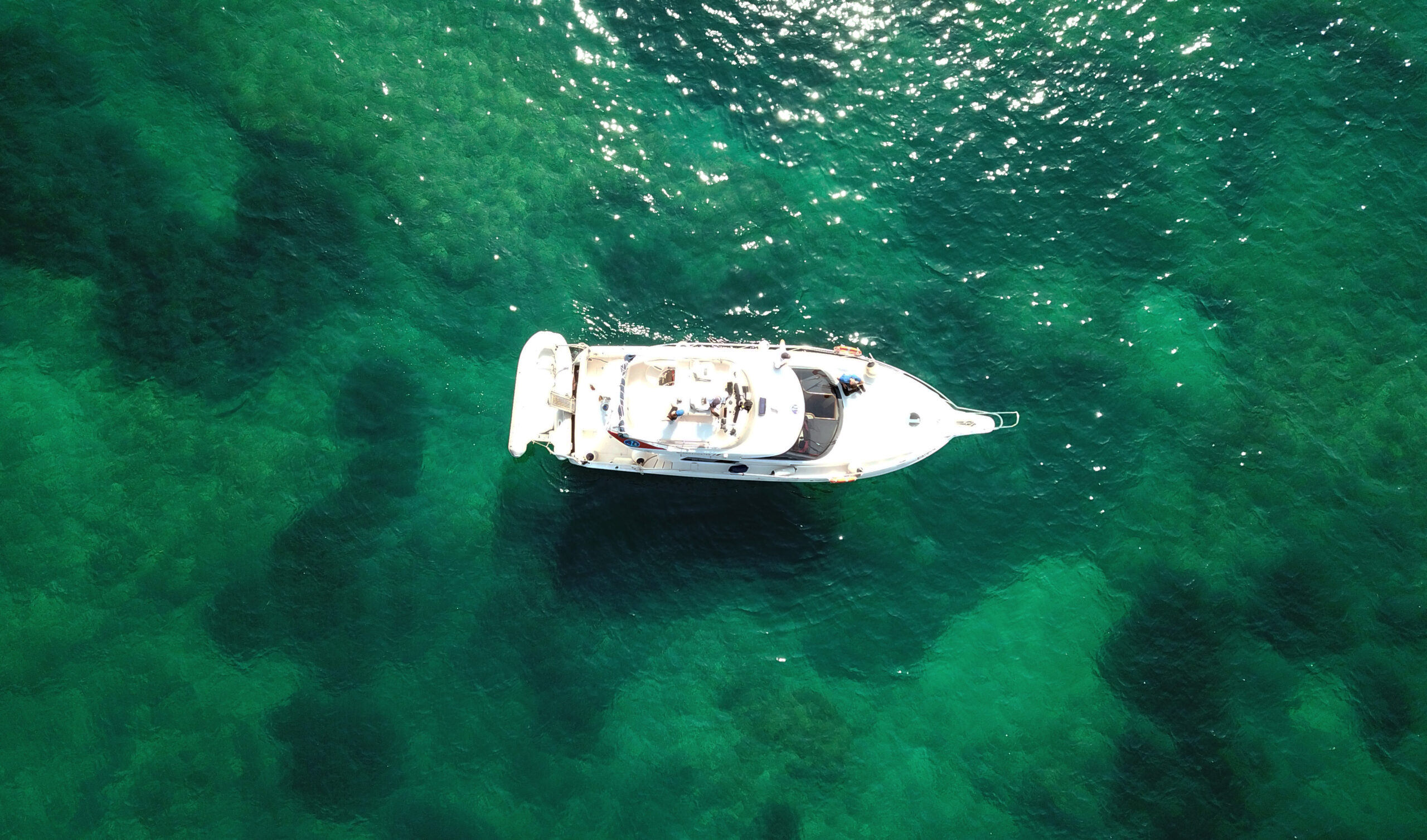
The mobile application is consolidated as the most complete tool on the Spanish coast with nearly 300,000 hectares mapped to avoid damaging the marine plant when anchoring.
The Castellón coastline joins the ‘Projecte Posidònia’ today, an initiative promoted by the Oceanogràfic Foundation and the Ciutat de les Arts i les Ciències (CACSA) that began in 2022 and unites science, technology, and outreach to protect posidonia meadows, one of the most productive and vulnerable ecosystems on the planet.
With the incorporation of the section between Oropesa del Mar and Benicàssim, the province has, for the first time, a mapping that is now available in the free mobile application, with the aim of helping nautical users to anchor responsibly.
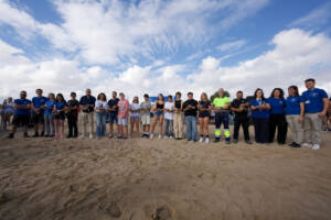
The presentation of the new mapping was held on Thursday at the facilities of the Fundación Azul Marino, in Oropesa del Mar, in an event that included the participation of the Minister of Environment, Infrastructure and Territory of the GVA, Vicente Martínez Mus, the regional secretary, Raúl Mérida, the general director, Luis Gomis, as well as the presidency and management of the Oceanogràfic Foundation and the Fundación Azul Marino and the mayors and councilors of the province.
A new section to protect a key ecosystem
The new marine section incorporated comprises a space recognized as a Site of Community Importance (SCI) and a Special Protection Area for Birds (SPA), with a current area of 1,317 hectares, with an application for expansion to reach 4,030 hectares.
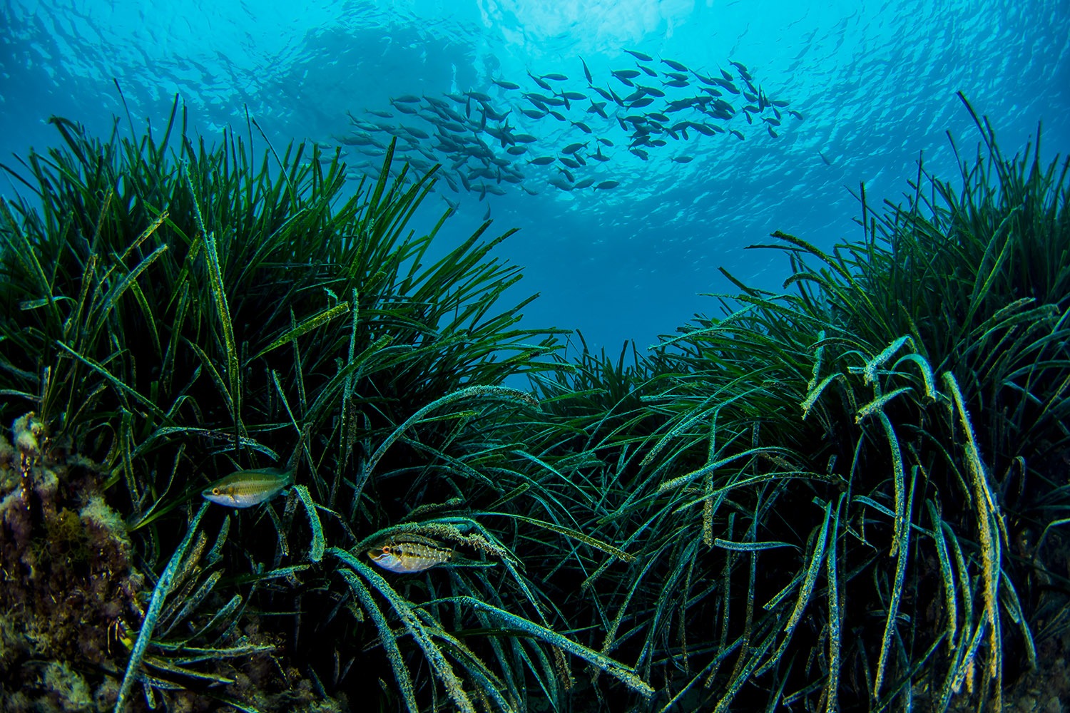
This mapping offers a detailed view of the species and habitats that live in the area, allows us to know what state they are in and helps to improve the protection of one of the most valuable marine ecosystems in the Mediterranean.
In total, 4,500 hectares (45 square kilometers) of seabed have been mapped, in which 15 square kilometers of Cymodocea nodosa meadows have been identified in open and deep areas and 9 square kilometers of Posidonia oceanica.
Areas of high coverage and density values have also been detected, as well as others in regression, which reinforces the need for preventive and management measures to ensure their conservation.

Applied science and outreach in the same project
Since its launch in April 2022, the ‘Projecte Posidònia’ has consolidated a comprehensive model of research and outreach. On the one hand, it develops a technical-scientific aspect focused on marine mapping using precision technologies such as side-scan sonar, towed underwater cameras and geopositioning.
On the other hand, it incorporates an outreach part that translates this scientific knowledge into practical tools and educational programs adapted to schools.
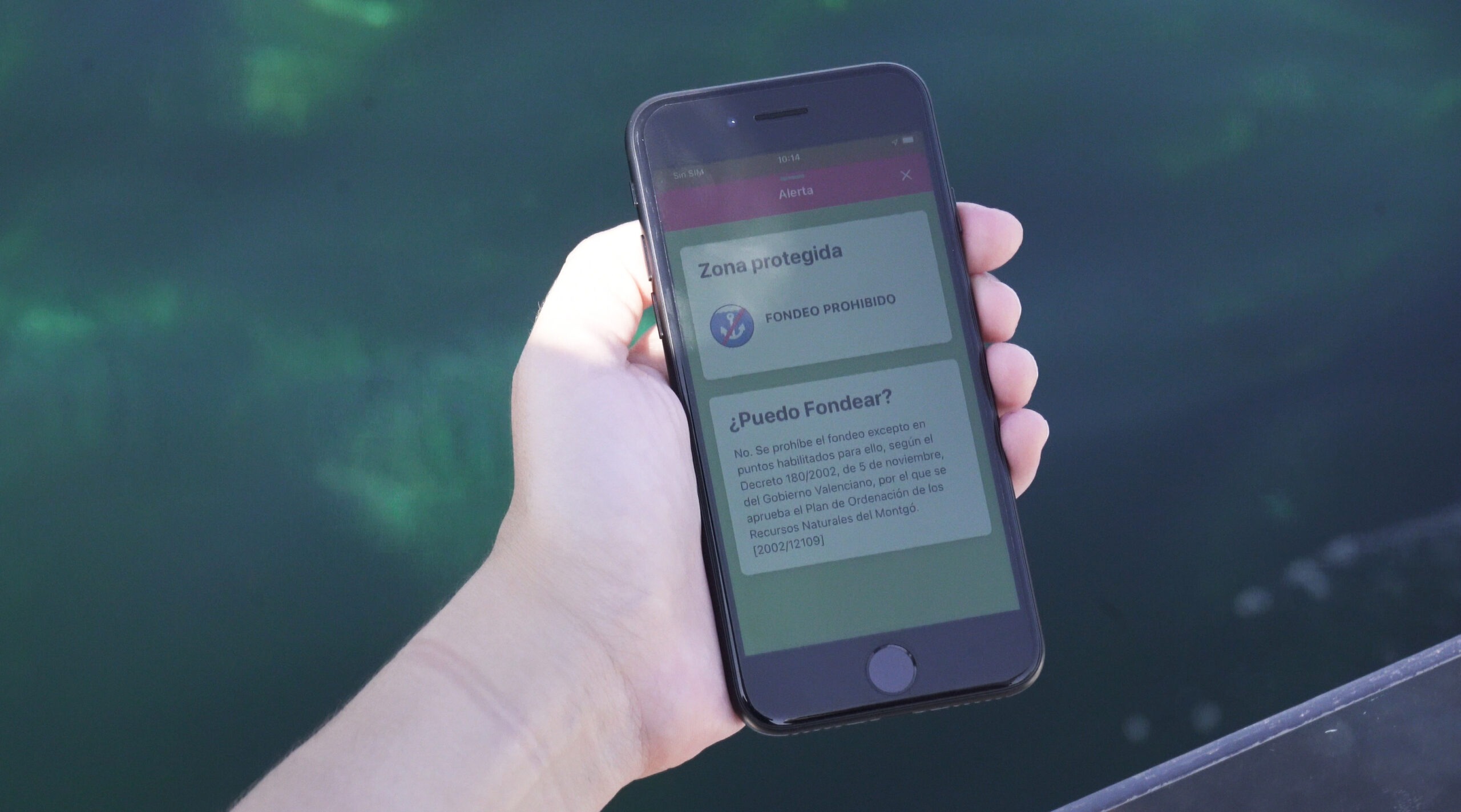
In this sense, the project generated a free mobile application available on iOS and Android, which allows you to consult in real time the areas with marine phanerogam meadows to anchor responsibly, minimizing the impact of boats on the seabed.
However, the value of this tool does not only lie in its nautical utility, but also in its role as a bridge between science and citizens, by facilitating access to quality ecological information in a clear, visual and useful way.
In addition, it includes information on the regulations and protection figures that apply to the different marine spaces.
Nearly 300,000 hectares mapped
The ‘Projecte Posidònia’ began three years ago with the mapping of nearly 7,000 hectares in the Marina Alta, including spaces of the Natura 2000 Network such as the Almadraba, the Montgó Natural Park and the Ifac marine area. In addition, that same year, the ‘Projecte Xàbia’ was incorporated, with an additional survey of 2,900 hectares.
In 2024, the scope of the project was expanded with the integration of the Parc Natural de la Serra Gelada in the Marina Baixa, with 5,120 hectares, and the Balearic coast, with more than 278,000 hectares contributed thanks to the Govern de les Illes Balears, of which 60,000 correspond to Posidonia oceanica meadows.
With the incorporation of the Oropesa–Benicàssim section, the total area mapped within the Projecte Posidònia amounts to nearly 300,000 hectares, which is equivalent to about 3,000 square kilometers of seabed analyzed and documented.
This figure places the project as one of the largest applied conservation initiatives in the western Mediterranean.
Beyond the data, the ‘Projecte Posidònia’ has been consolidated as an educational and social transformation tool with more than 4,000 downloads of its application. In recent years, it has developed school campaigns, workshops and interpretive materials in educational centers in the municipalities involved, with the aim of ensuring that new generations understand the value of marine biodiversity and participate in its protection.
Other news that may interest you